Joel W Grossman © 1991 - 2007 All right reserved
The Historic GIS of Washington Square Park,
Manhattan, New York
Manhattan, New York
Joel W Grossman © 1991 - 2007 All right reserved
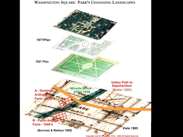
3D GIS of Washington Square Park: Showing Historic association between the Park, one of Bolton's major Native American roads crossing at Minetta Brook, and east of the indigenous landing and transhipment settlement of Sapohanikan, and the site of two of Manhattan's earliest black farmsteads outsid the walls of mid-17th Century Dutch New Amsterdam (Grossman © 2007)
Double click to edit
Double click to edit
Joel W Grossman © 1991 - 2007 All right reserved
Joel W Grossman © 1991 - 2007 All right reserved


Joel W Grossman © 1991 - 2007 All right reserved
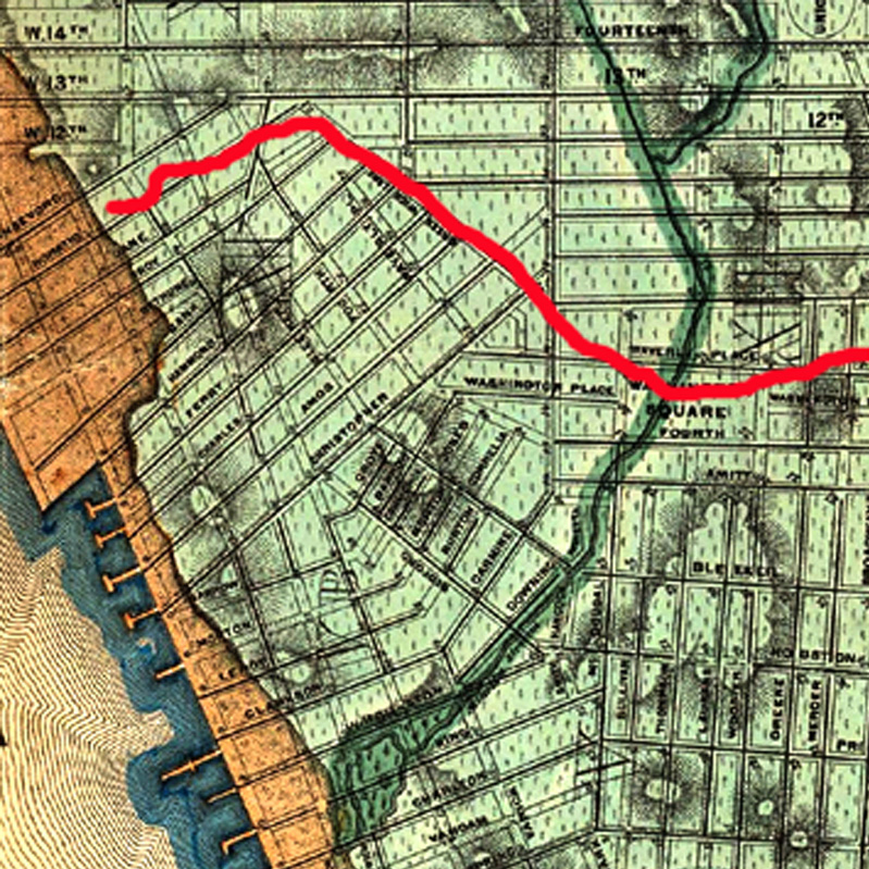
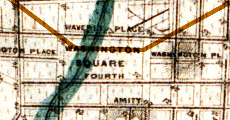
Detail of Viele 1865 with Bolton's Native American path superimposed to scale.
3D Scaled Terrain model of Viele, showing Bolton's Native American roadway crossing Minetta brook. Model by Joel W. Grossman, Ph.D.(Grossman ©2007 All rights reserved - Not for duplication)
Close-up "birds-eye-view" of 3D terrain model of the 17th Century setting of Washington Square Park showing Bolton's Native American roadway crossing Minetta Brook and two mid-17th Century black farmsteads bordering each bank of the stream. Model by Joel W. Grossman, Ph.D.(Grossman ©2007 All rights reserved - Not for duplication)
Joel W Grossman © 1991 - 2007 All right reserved