
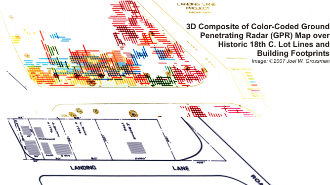
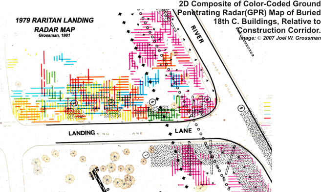
2007 Image Enhancement of Original Color Ground Penetrating Radar Maped through three feet of shale overburden, and never before publisheed in color (cf Grossman 1980). the Images werre digitized and restored by Dr. Grossman and then georeferenced to the 18th century historic lot lines and known building footprints. The defined anomalies of the significantly denser Radar Map showed direct geographic correlations with excavated structures in 1979 (Grossman 1980, 1982, 2003, 2007a)
[Raritan Landing -1979] [Broad St. - 1984] [Fort Edward - 1986] [Loiza - 1987]
[Superfund at West Point Foundry -1989-1995] [Early LIDAR in Albany-1999] [Meadowlands GIS Plan - 1992 - 2006] [Mitigation Plan - Furnace Falls 2002 ]
[Furnace Dalls - Color LIDAR -2004]
[Superfund at West Point Foundry -1989-1995] [Early LIDAR in Albany-1999] [Meadowlands GIS Plan - 1992 - 2006] [Mitigation Plan - Furnace Falls 2002 ]
[Furnace Dalls - Color LIDAR -2004]