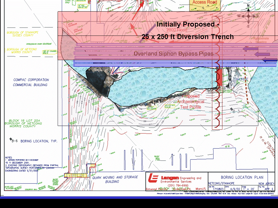
Engineering CAD site plan of immediate impact area of historic channel and dam showing the design changes implemented to reduce and/or avoid impacts to the Civil War foundry along both banks of the Musconetcong River and the movement of flood control sheeting upriver to avoid cutting into any submerged historic elements. The subsequent excavation, documentation and laser-radar recordation addressed only elements that could not be avoided through redesign (Grossman 2002, 2004 & 2007a).