[Historic Impact Analysis] [3D Paleoenvironmental Reconstruction of the Meadowlands]
[Raritan Landing -1979] [Broad St. - 1984] [Fort Edward - 1986] [Loiza - 1987] [Superfund at West Point Foundry -1989-1995] [Early LIDAR in Albany-1999]
[Meadowlands GIS Plan - 1992 - 2006] [Mitigation Plan - Furnace Falls 2002 ] [Furnace Dalls - Color LIDAR -2004]

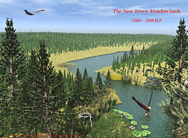
A 3D paleo-environmental reconstruction of prehistoric topography and habitat of the formally exposed New Jersey Meadowlands as it was before being inundated by rising sea levels ca. 2000-3000 BP. The digital terrain model, or 3D surface-mesh model, is derived from georeferenced 1865 US Army survey of bathymetry and mud-depth readings in the Hackensack Basin. The environmentally accurate 3D prehistoric tree and plant cover is identified from radiocarbon-dated pollen cores (see Grossman 1992, 1994, 1995 2003, 2006 & 2007 in Hunter Research 2006 & 2007a for additional discussion of the logistical and planning utility of these pre-landfill reconstructions; see Grossman 2007a for discussion and background).)