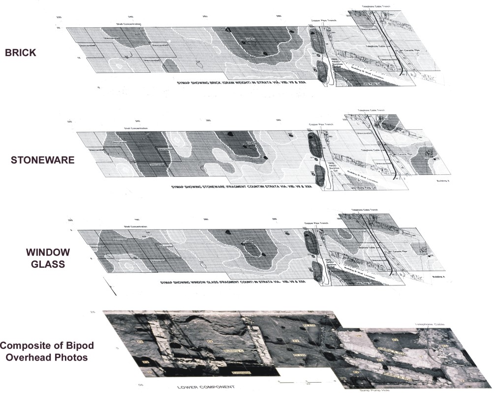
Raritan Landing - 1979: Scaled Geospatial Comparison of Early Mainframe-Generated SYMAP Artifact Density Distribution Plots, Georeferenced to the Composit Photomosaic of the Excavated Pre-Revolutuionary 1730 Living Surface (Grossman 1980, 1982)
[Raritan Landing -1979] [Broad St. - 1984] [Fort Edward - 1986] [Loiza - 1987]
[Superfund at West Point Foundry -1989-1995] [Early LIDAR in Albany-1999] [Meadowlands GIS Plan - 1992 - 2006] [Mitigation Plan - Furnace Falls 2002 ]
[Furnace Dalls - Color LIDAR -2004]
[Superfund at West Point Foundry -1989-1995] [Early LIDAR in Albany-1999] [Meadowlands GIS Plan - 1992 - 2006] [Mitigation Plan - Furnace Falls 2002 ]
[Furnace Dalls - Color LIDAR -2004]