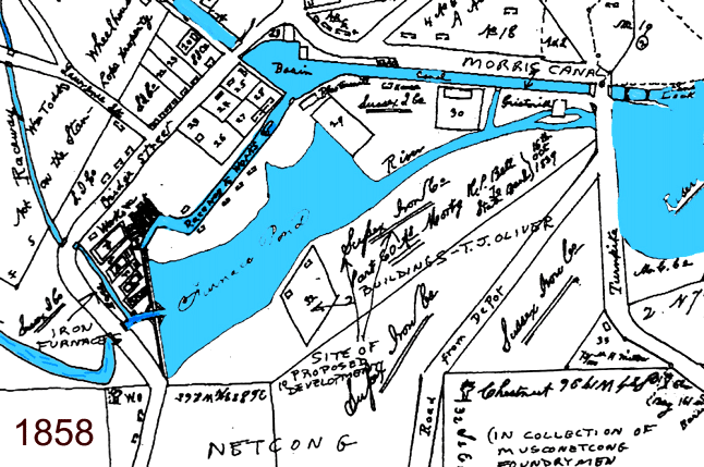
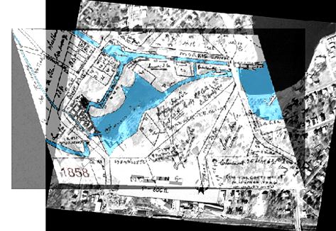
Grossman 2007 Note: 1865 map Georeferenced and reprojected to match modern air phot coverage in scale and coordinates. The historic GIS, or Historic Impact Analysis (Grossman 1997, 2004, 2007b) indicated that the historic and modern alignments were the same, that the original early 19th Century dam was over 400 feet in length, and it was possible that historic elements could have survived under the 20th century flood control additions. They did. (Historic GIS by George Davis of Davis Assoc., Inc.; See Grossman 2002, 2004, 2007)
[ff-Report] [ff_Flood] [ff_DEM_Stanhope] [ff_1828_Map] [ff-3DGIS_GDavis] [ff-Base_Map] [ff-Haul_Road_Map] [ff-1858_gismap] [ff-Foundry_Recon] [ff-Foundry_gis] [FF-CAD_plan] [ff-Jeff-Joel]
[ff_Wintersite] [ff-Dewatering] [ff-Deicing] [ff-Draining] [ff_EDM-GPS] [ff-LIDAR] [ff-LidarScan1] [ff-LidarScan2] [ff-LidarScan3] [ff-RolleDmProfile] [ff-Rollie-Lidar]
[ff_Wintersite] [ff-Dewatering] [ff-Deicing] [ff-Draining] [ff_EDM-GPS] [ff-LIDAR] [ff-LidarScan1] [ff-LidarScan2] [ff-LidarScan3] [ff-RolleDmProfile] [ff-Rollie-Lidar]
[Raritan Landing -1979] [Broad St. - 1984] [Fort Edward - 1986] [Loiza - 1987] [Superfund at West Point Foundry -1989-1995] [Early LIDAR in Albany-1999]
[Meadowlands GIS Plan - 1992 - 2006] [Mitigation Plan - Furnace Falls 2002 ] [Furnace Falls - Color LIDAR -2004]
[Meadowlands GIS Plan - 1992 - 2006] [Mitigation Plan - Furnace Falls 2002 ] [Furnace Falls - Color LIDAR -2004]
To LIDAR Slideshow
To LIDAR Videos