Raritan Landing - 1979. Undisturibed flat-field metric Bi-pod overhead of post-1780 destruction debris, surround post-1730 building foundations discovered preserved 4 ft of 20th century shale fill. Building were identified by the Ground Penetrating scans through the shale and then targed in the subsequent high-speed data recovery mitigation(Grossman 1980).
Raritan Landing - 1979. Bi-pod overhead of pre-Revolutionary War drain system discovered with Ground Penetrating Radar scan through fill and overburden. (Grossman 1980; Image Enhancment Grossman 2007)
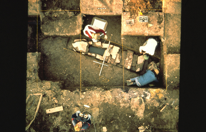
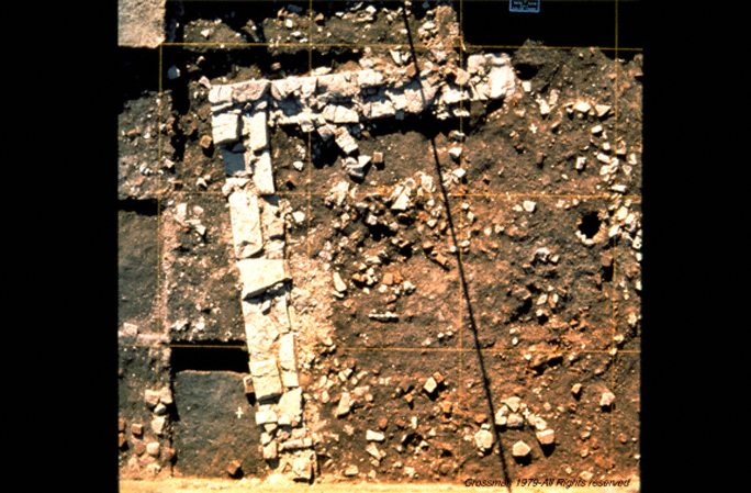
Overhead Pi-Pod metric Photographs at Raritan landing - 1979
[Raritan Landing -1979] [Broad St. - 1984] [Fort Edward - 1986] [Loiza - 1987]
[Superfund at West Point Foundry -1989-1995] [Early LIDAR in Albany-1999] [Meadowlands GIS Plan - 1992 - 2006] [Mitigation Plan - Furnace Falls 2002 ]
[Furnace Dalls - Color LIDAR -2004]
[Superfund at West Point Foundry -1989-1995] [Early LIDAR in Albany-1999] [Meadowlands GIS Plan - 1992 - 2006] [Mitigation Plan - Furnace Falls 2002 ]
[Furnace Dalls - Color LIDAR -2004]