2007 Note: Single-camera photogrammetric (Rollemetric) profile of sectioned 1830 Morris Canal dam at furnace Falls, Stanhope/Netcong, New Jersey, taken by the Dr. Grossman moments before he was pulled to safety as the embankment collapsed from the release of the dammed-off & diverted Musconetcong River flood waters. The 90 degree 90 degree flat-field lens and camera captured an undistorted, metrically accurate, cross ssection of the structure that was then georeferenced to the high-resolution terrestrial color Lidar scan to produce the first integrated, photogrammetric-laser-radar record of an archaeological site. (Rolleimetric Photo By Joel W. Grossman, Grossman 2004, Figure 31: See Grossman 2007b, Archaeology of Toxic and Hazardous Environments, Encyclopedia of Archaeology, Pearsall, D. (Ed.), Elsevier / Academic Press, Oxford, England.
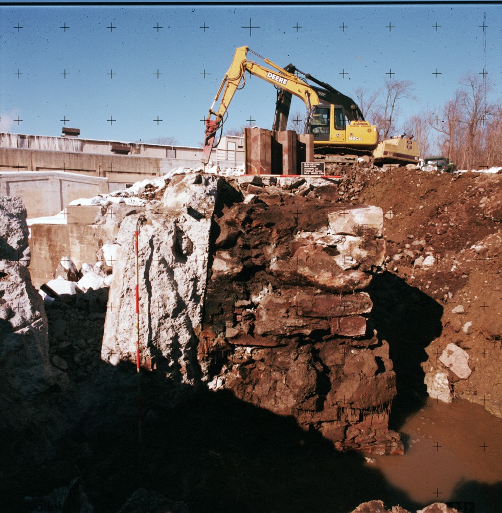
Photo & Graphics By Joel W. Grossman Copyright © 2007 Joel W. Grossman, All rights reserved
[ff-Report] [ff_Flood] [ff_DEM_Stanhope] [ff_1828_Map] [ff-3DGIS_GDavis] [ff-Base_Map] [ff-Haul_Road_Map] [ff-1858_gismap] [ff-Foundry_Recon] [ff-Foundry_gis] [FF-CAD_plan] [ff-Jeff-Joel] [ff_Wintersite]
[ff-Dewatering] [ff-Deicing] [ff-Draining] [ff_EDM-GPS] [ff-LIDAR] [ff-LidarScan1] [ff-LidarScan2] [ff-LidarScan3] [ff-RolleDmProfile] [ff-Rollie-Lidar]
[ff-Dewatering] [ff-Deicing] [ff-Draining] [ff_EDM-GPS] [ff-LIDAR] [ff-LidarScan1] [ff-LidarScan2] [ff-LidarScan3] [ff-RolleDmProfile] [ff-Rollie-Lidar]
To LIDAR Slideshow
To LIDAR Videos
[Raritan Landing -1979] [Broad St. - 1984] [Fort Edward - 1986] [Loiza - 1987] [Superfund at West Point Foundry -1989-1995] [Early LIDAR in Albany-1999]
[Meadowlands GIS Plan - 1992 - 2006] [Mitigation Plan - Furnace Falls 2002 ] [Furnace Falls - Color LIDAR -2004]
[Meadowlands GIS Plan - 1992 - 2006] [Mitigation Plan - Furnace Falls 2002 ] [Furnace Falls - Color LIDAR -2004]