
THE FLOOD
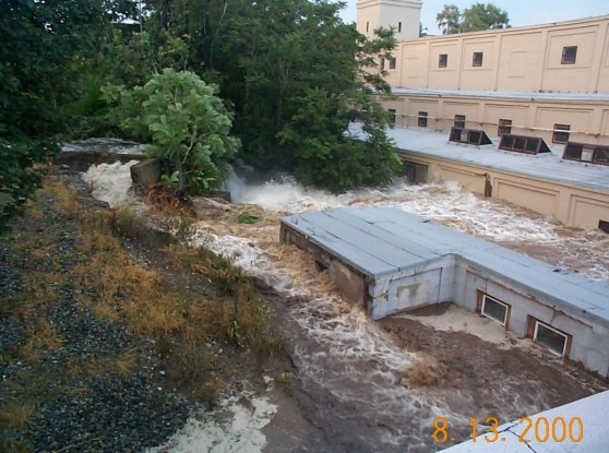
(Grossman 2002, fig 20)
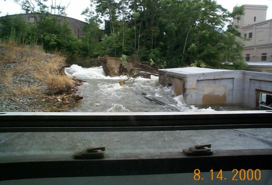
(Grossman 2002, fig 21)

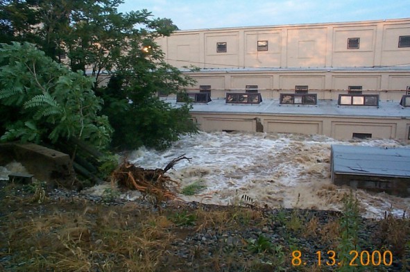
The Breach of Furnace Falls Dam - 2000 Photo By Ernest Hazelton Copyright © Ernest Hazelton 2000-2007 All rights reserved.
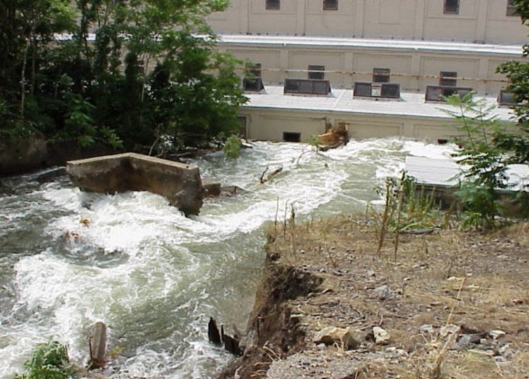
(Grossman 2002, fig 22)
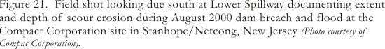
(Grossman 2002, fig 23)
Note: the following photographs were taken at the time of the flood and breach of Furnace Falls Dam by, and are being shown courtesy of, Mr. Ernest Hazelton, Compac Corporation Health and Safety Officer for the project. In addition to destroying the dam itself, the flood caused major destruction and loss of property to Compac Corporation and other river-side facilities in the drainage.
[ff-Report] [ff_Flood] [ff_DEM_Stanhope] [ff_1828_Map] [ff-3DGIS_GDavis] [ff-Base_Map] [ff-Haul_Road_Map] [ff-1858_gismap] [ff-Foundry_Recon] [ff-Foundry_gis] [FF-CAD_plan] [ff-Jeff-Joel]
[ff_Wintersite] [ff-Dewatering] [ff-Deicing] [ff-Draining] [ff_EDM-GPS] [ff-LIDAR] [ff-LidarScan1] [ff-LidarScan2] [ff-LidarScan3] [ff-RolleDmProfile] [ff-Rollie-Lidar]
[ff_Wintersite] [ff-Dewatering] [ff-Deicing] [ff-Draining] [ff_EDM-GPS] [ff-LIDAR] [ff-LidarScan1] [ff-LidarScan2] [ff-LidarScan3] [ff-RolleDmProfile] [ff-Rollie-Lidar]
[Raritan Landing -1979] [Broad St. - 1984] [Fort Edward - 1986] [Loiza - 1987]
[Superfund at West Point Foundry -1989-1995] [Early LIDAR in Albany-1999] [Meadowlands GIS Plan - 1992 - 2006] [Mitigation Plan - Furnace Falls 2002 ]
[Furnace Falls - Color LIDAR -2004]
[Superfund at West Point Foundry -1989-1995] [Early LIDAR in Albany-1999] [Meadowlands GIS Plan - 1992 - 2006] [Mitigation Plan - Furnace Falls 2002 ]
[Furnace Falls - Color LIDAR -2004]
To LIDAR Slideshow
To LIDAR Videos
The Breach of Furnace Falls Dam - 2000 Photo By Ernest Hazelton Copyright © Ernest Hazelton 2000-2007 All rights reserved.
The Breach of Furnace Falls Dam - 2000 Photo By Ernest Hazelton Copyright © Ernest Hazelton 2000-2007 All rights reserved.
The Breach of Furnace Falls Dam - 2000 Photo By Ernest Hazelton Copyright © Ernest Hazelton 2000-2007 All rights reserved.